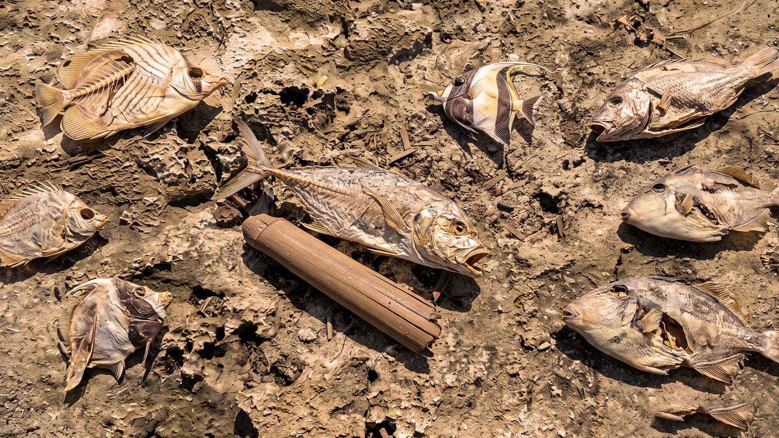
If you have walked one of Guam's reef flats on a hot afternoon this year, you have probably seen it: the shallow platform drained down to bare rock and coral, the tide pulled back farther than it has any business going, and small reef fish scattered across the exposed flat — curing in the sun like strips of jerky. Pair that with the suffocating heat and thick humidity, and it feels as though the ocean itself is reacting to something big.
That "something" is El Niño.
Most islanders file El Niño under typhoons and drought. But its first visible act happens right at the waterline — on the reef flats we fish, gather, and grew up on. Here is the marine science behind what is happening on our shores, what the reef record from the last major event tells us, and what the forecasters say is coming.
This is not hypothetical this year. As of NOAA's July 2026 advisory, a strengthening El Niño is underway — the Niño-3.4 index sits at +1.2 °C above average, and forecasters give an 81% chance of a very strong event by October–December 2026, potentially one of the largest since 1950. The reef-flat conditions described below are the conditions we are walking into.
01The "Sloshing" Pacific: Why the Tides Go So Low
Under normal conditions, strong easterly trade winds push warm surface water toward the Western Pacific, piling it up around Micronesia and Indonesia and holding our regional sea level higher. During an El Niño, those trade winds weaken or reverse, and that warm water "sloshes" back east toward the central and eastern Pacific near South America.
For Guam, the pile-up drains away. Regional sea levels around the Marianas can fall by several inches to a foot or more during a strong event, and the drop typically begins in the summer of the El Niño year and deepens through winter. Layer a normal afternoon low tide on top of an already-lowered sea level and you get extended low-stand events — shallow back-reefs and flat reef platforms left high, dry, and baking in the sun for hours at a stretch.
02Why the Fish Are Drying on the Flat
Extreme low water plus tropical sun turns the reef flat into a trap:
Thermal stress and oxygen collapse. As the tide drops, seawater gets stranded in shallow pools. Under direct sun those pools heat fast — and warm water simply cannot hold as much dissolved oxygen. The result is hypoxia: oxygen starvation. A pool that hits the mid-30s °C in the afternoon can carry roughly a quarter less oxygen than the same water at a comfortable 20 °C.
Trapped marine life. Small reef fish, crustaceans, and juveniles feeding on the flat get caught in these hot, low-oxygen pools. With no route back to deeper water, many suffocate or succumb to heat shock. When the high tide finally returns, it lifts the dead out of the pools and lines them along the beach.
Corals left in open air. Reef-flat builders like staghorn Acropora are the worst-hit. Left exposed to direct sun and air — "subaerial exposure," in the literature — their tissue bleaches and dies within hours, gutting the habitat and food web the fish depend on.
03What the Reef Record Actually Shows
This is not a new or theoretical threat for Guam — it already happened, and scientists measured it. Between 2013 and 2017, Guam's reefs were hit by four island-wide bleaching events (2013, 2014, 2016, and 2017). Accumulated heat stress in 2013 was the highest since satellite monitoring began — a record then broken again in 2017. Riding on top of that heat, a major ENSO event drove extreme low tides through 2014 and 2015, killing shallow corals outright by subaerial exposure on the reef flats.
The toll, documented by University of Guam Marine Laboratory researchers (Raymundo and colleagues, Coral Reefs, 2019), was severe:
Live coral cover lost at shallow reef-flat sites along the west coast.
Live cover lost across Guam's staghorn Acropora communities by 2017.
Live coral cover lost on the hardest-hit eastern reefs.
The science has moved fast since. Researchers are now working to predict these exposure events before they happen: a 2026 study in the Journal of Geophysical Research: Oceans modeled extreme and low-frequency water levels on the Ipan, Guam reef flat, and NOAA's Guam extreme-tide project is building forecasts specifically to time coral restoration around the low-stand windows. In other words — the drying reef flat you are seeing is now a measured, modeled, and managed problem.
04The Weather Pattern: Heat First, Then Drought
The sweltering, glassy, no-wind heat islanders are feeling is a hallmark of El Niño's atmospheric shift — and it does not stay put. The event moves through phases, and the tail end is a serious dry season.
| Phase | What to expect on Guam |
|---|---|
| Early (onset) | Weakened trade winds, higher humidity, calm glassy seas, intense daytime heating, and the first extreme low tides. |
| Peak | Tropical-cyclone formation zones shift; heightened risk of a major typhoon reaching the region. |
| Late (post-peak) | A prolonged, severe dry season — rainfall crashes below average, streamflow drops, and wildfire risk climbs, usually peaking around April of the following year. |
As atmospheric scientists and local National Weather Service meteorologists note, strong westerly wind bursts in the Pacific can trigger and reinforce these El Niño conditions, disrupting the baseline weather the island runs on.
05The Typhoon Connection
El Niño also changes where storms are born. In a normal year, tropical cyclones often form farther west, giving Guam less exposure to fully mature systems. During a strong El Niño, the genesis zone shifts eastward toward Micronesia — handing disturbances thousands of miles of open, overheated ocean to strengthen into major typhoons before they ever reach the Marianas.
That elevated risk is not a forecast of any single storm — it is a loading of the dice. Some strong El Niño years deliver multiple direct hits; others thread the storms past the island entirely. The move is to treat the season as higher-risk and prepare accordingly.
How to Read It — and How to Prepare
Trust the local briefing, not the app. Commercial weather apps display raw long-range model output that swings wildly every few hours. For anything that matters, rely on the localized briefings from NWS Weather Forecast Office Guam (weather.gov/gum).
Harden early. The heat-and-calm phase is your window — secure structures, prep and test generators, keep reserve batteries and potable water, and stock non-perishables before the peak-phase storm risk arrives.
Give the reef room. During extreme low tides, stay off the exposed coral flats. Corals already under heat stress snap underfoot, and every colony broken during a low-stand is one fewer that recovers when the water returns.
The reef flats that dry out in an El Niño summer are the same nurseries that feed our hunting the rest of the year. When the water's this low, we don't walk the flat and we don't work the trapped pools — we let it ride. Protecting that habitat through a low-stand is the difference between a reef that bounces back by next season and one that takes a decade. Fish the deeper ledges, leave the flat alone, and let it heal.
The Bottom Line
The exposed reef, the drying fish, the dead-calm heat — they are not random. They are the visible front edge of a Pacific-wide shift that we can now name, measure, and to a real degree predict. Guam has been through it before, and the reef paid for it: a third of our coral, and more, gone in a handful of years. Knowing the mechanism does not stop the tide from dropping — but it tells us when to protect the flat, when to harden for storms, and when to expect the dry season on the other side.
Watch the waterline. Stay off the coral. And when you see the fish jerky start showing up on the flat, you'll know exactly what the ocean is telling you.
Sources & Further Reading
- Raymundo, L. J., et al. "Successive bleaching events cause mass coral mortality in Guam, Micronesia." Coral Reefs 38 (2019). Springer
- NOAA Climate Prediction Center — ENSO Diagnostic Discussion & El Niño Advisory (July 2026). cpc.ncep.noaa.gov
- NWS Pacific ENSO Applications Climate Center — "El Niño Impacts on Guam and the CNMI." weather.gov/peac
- Becker, J. M., et al. "Estimates of Extreme and Low-Frequency Reef-Flat Water Levels at Ipan, Guam." JGR: Oceans (2026). AGU
- NOAA Coral Reef Information System — Predicting extreme tide events to inform Guam reef restoration. coris.noaa.gov